During the weekend of July 13th, 2019 my climbing partner and I attempted and succeeded in climbing Mt. Shasta via the West Face. This was my first large mountaineering climb without a guide and having planned the trip ourselves. A cold alpine start ran into mild altitude sickness, navigation error, and unexpected weather on our descent. This is a (very late) trip report detailing our planning, the climb, and lessons learned.
The Plan
Our plan was to drive to Mt. Shasta during the early day and hike during the afternoon from the Bunny Flats trailhead to the Hidden Valley camp Saturday to set up camp. We’d then get an alpine start on the summit bid at 2am on Sunday morning continuing up the standard West Face route that links to Misery Hill for the final summit climb. Our absolute turn around time was set for noon.
The Climb
My partner and I set off from the Bay area for a 6 hour drive to Bunny Flat trailhead parking. It was an exciting start albeit felt a bit awkward leaving for a mountain so late in the morning but this worked out quite well! The trek was mostly wet dirt except for scattered patches of snow up to the Horse Camp hut. The trail to Hidden Valley camp threw a few scree fields and isolated snowfields to traverse. We arrived at camp a few hours before sunset and had just enough time to cook and prepare for the next morning without roasting on the mountain during the daytime in our tent.
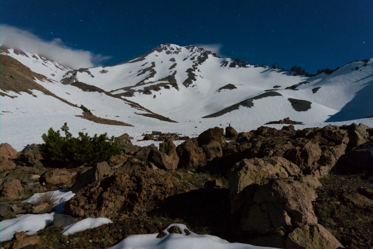
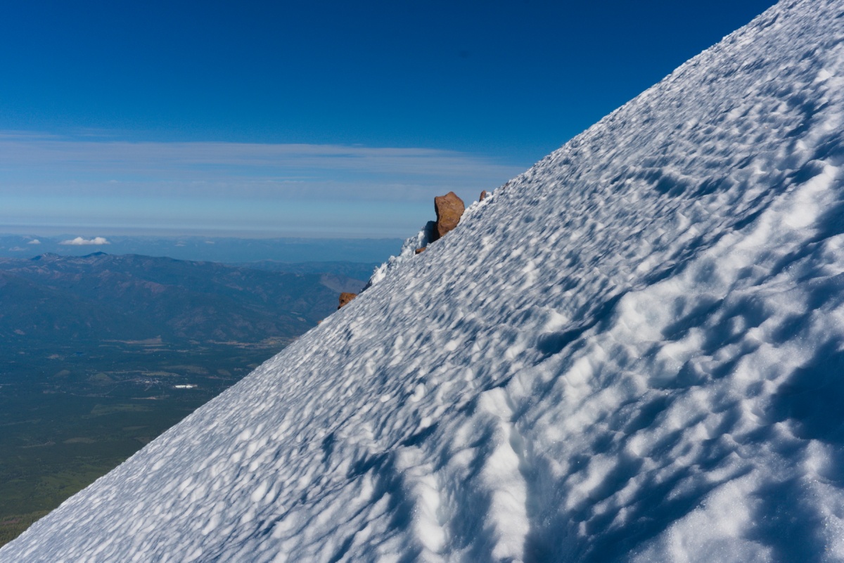
The Hidden Valley campsites were on dry ground surrounded by the snowfield in front of the West Face. We met only a handful of other climbers on this route, I actually knew and worked with a few of them in my past life at SpaceX… It’s a small world! As my partner made his way to bed I took a half hour or so to take some night photography shots of Mt. Shasta. It was a beautiful, seemingly full moon lit night that blew wispy clouds sporadically off the peak. Our mission the next day was to safely climb up the middle of this photo below.
Before settling in for bed we discussed and decided to move our wake-up time to 1:30am. Alarms buzzed and we woke, made coffee, ate, and dressed for the adventure awaiting us. Hiking across the snow and rock field to the first real incline was much longer than it seemed during the daytime. We were greeted with a steep incline within a chute that lead to a more reasonable sustained climb up the brunt of the face. We made good time and felt great (and of course a bit tired from our alpine start) as the sun began to rise.
As we trudged onward we could hear the excitement in our voices turn to a mixture of tired, heavy breathing at the high altitude. We had several thousand feet of climbing to do and thick clouds rolled in partially causing a navigation error on my part leading us a bit off route to the climbers right. We fixed the error when we realized and continued upwards.
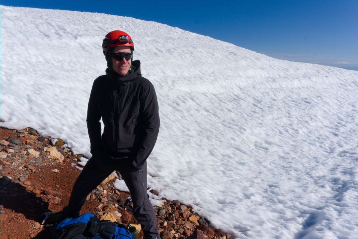
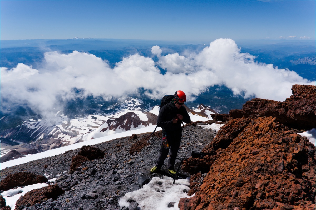
My partner was starting to feel mild altitude sickness. I knew that in the past I’ve felt it above 12,000 feet and was assessing myself, and my partner. Surprisingly, I was feeling great. We decided to continue at a slower pace and make sure we’re eating and drinking. I began to watch him more closely and ensure his altitude sickness was the “I’m feeling nauseous and tired” kind and didn’t start showing signs of incoherence, wobbling, or threatening to vomit. We made way up for the top of the West Face route that meets with the Avalanche Gulch (and several other routes) at Misery Hill. The last few hundred feet of elevation had some of the steepest snow on the route. I was a bit nervous prior but being on this ~40 degree slope but it felt much more comfortable in person! Reaching the ~13,000 foot West Face We agreed that if I felt he was progressing towards more severe symptoms we’d turn around no questions asked on his part. He also could turn us around with no questions asked.
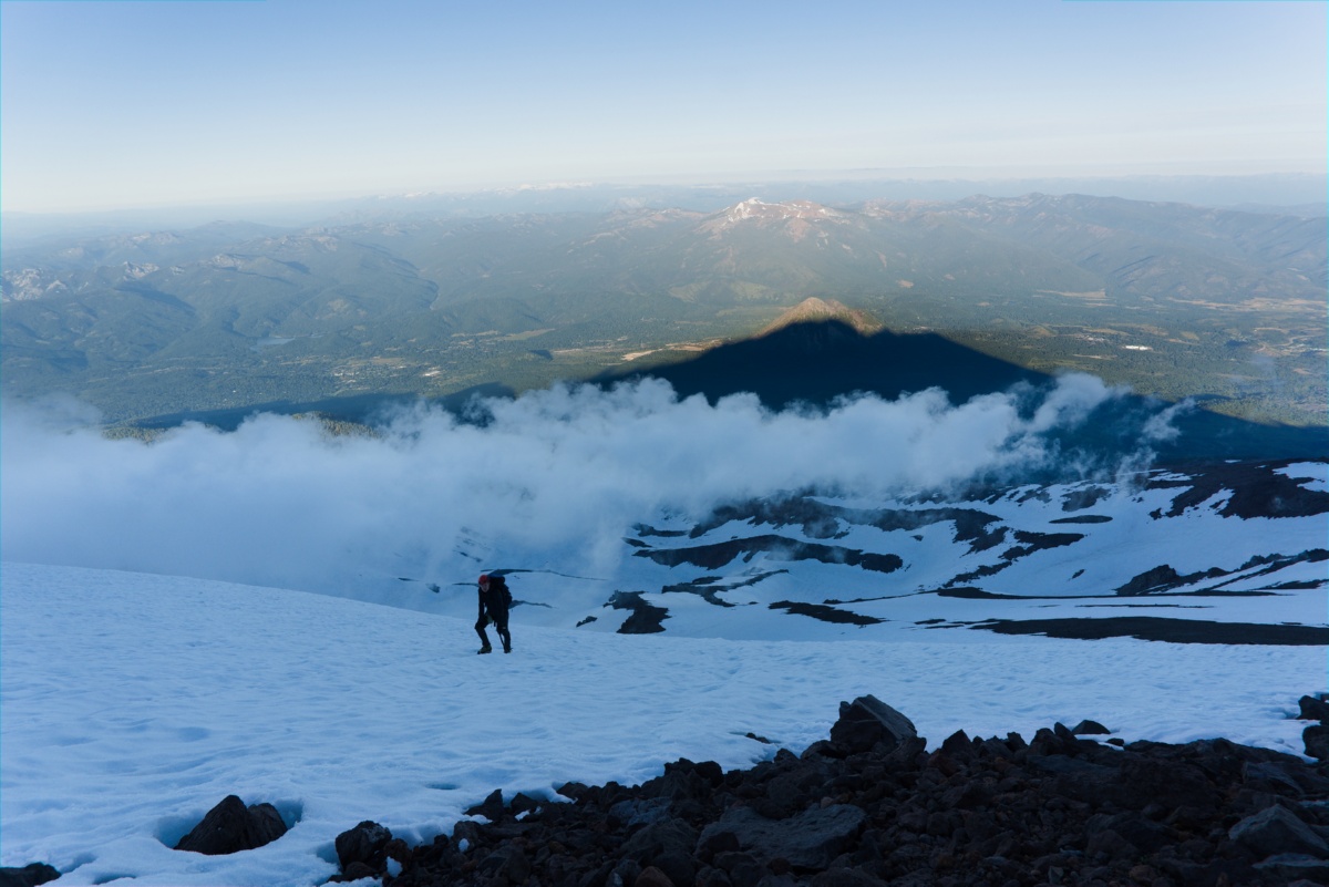
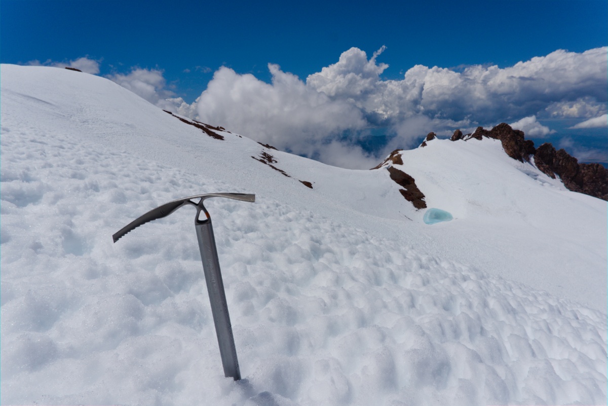
At the top of the West Face the view was beautiful! We could gaze down into the Whitney Glacier and then over to Misery Hill. Misery Hill was dotted with specs of climbers slowly making their way up the aptly named hill. The West Face provides a comforting false summit leaving all of Misery Hill’s not so comforting ~1000 feet of elevation for round two. We traversed above the Whitney Glacier and found ourselves amongst the crowds of Avalanche Gulch climbing our last hill.
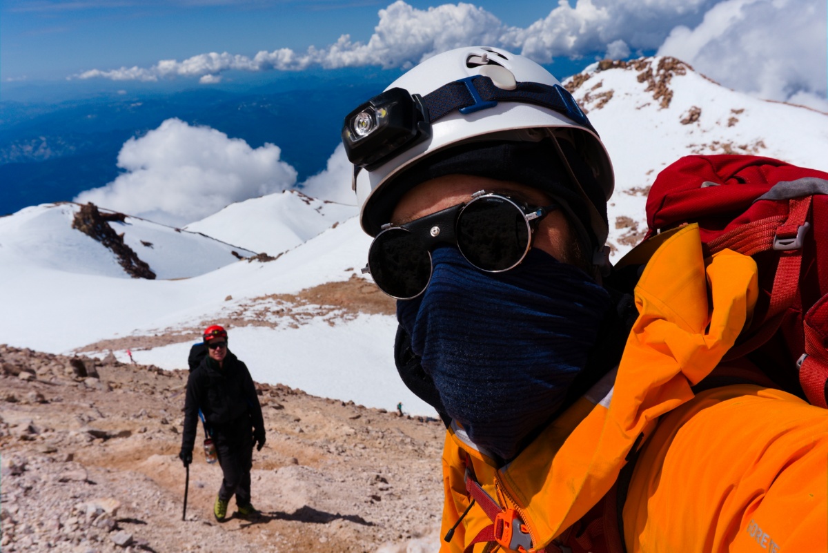
Misery Hill was mostly a rocky trail this late in the season, my partner was still feeling the altitude and slow but in good spirits! Lightly spotted clouds formed around us and brought the occasional snowflakes passing by us. This made for an amazing summit climb but may have been a forewarning to our descent…
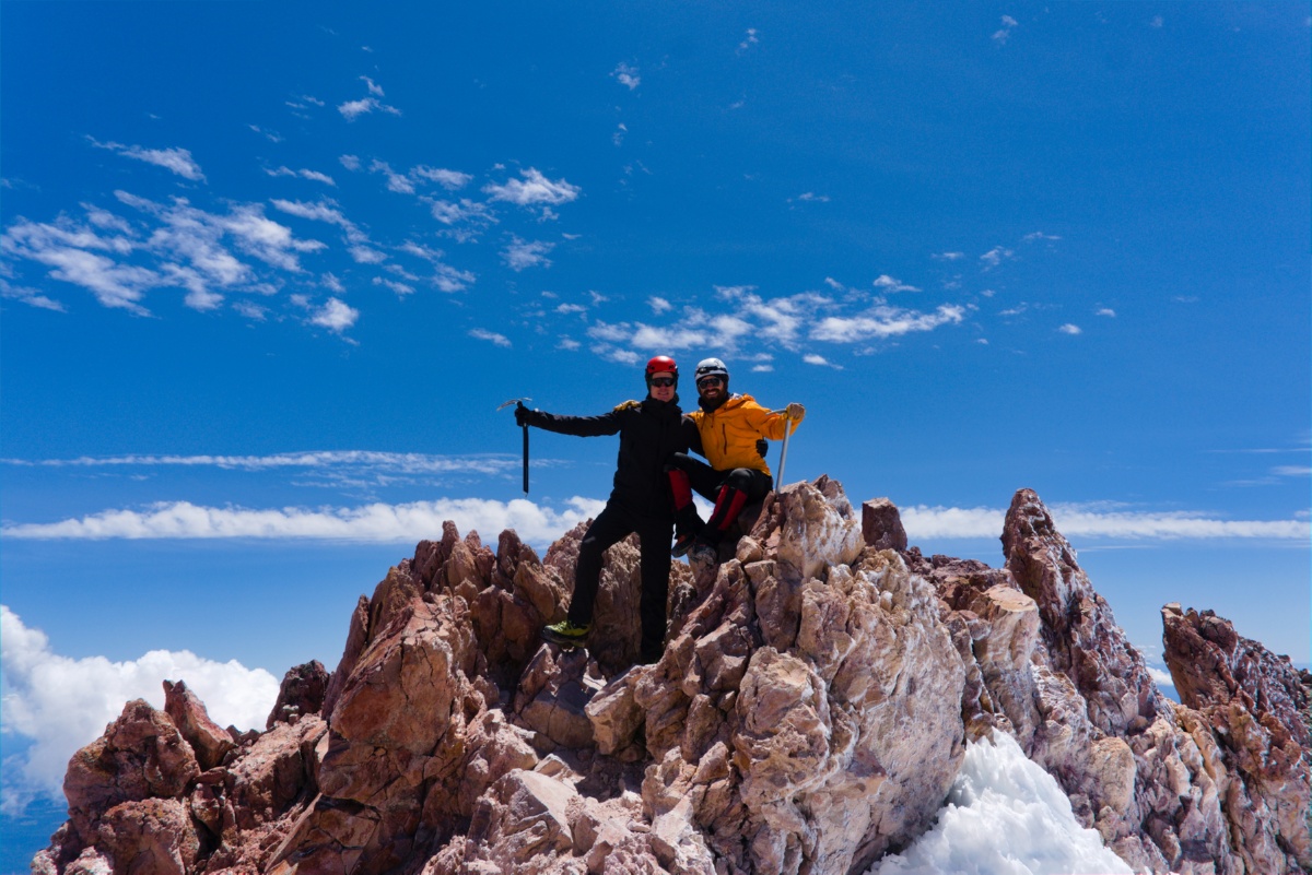
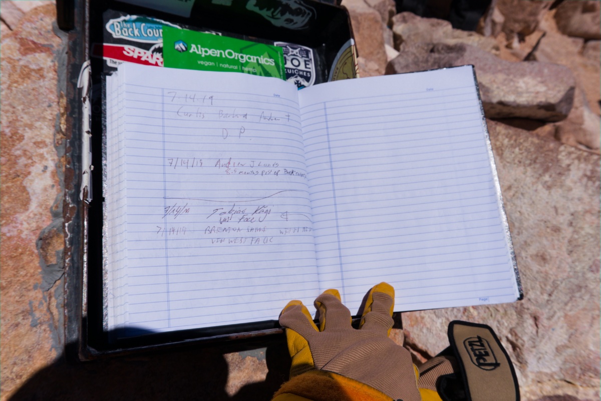
We reached the summit at approximately 11am and signed the summit log, took some photos, and took in the view. Now we were tired and no longer had the summit ahead of us but instead 5,000 feet of descending to our camp then packing out to our car.
As we traversed above the Whitney Glacier thicker clouds rolled in, some being thick enough to risk not seeing eachother 50 feet apart! We stayed close and found the top of the West Face route again. The other climbing party on the west face had already descended and we found their glissading tracks. We happily knew this route let climbers glissade nearly the entire ~4,000 feet and took our opportunity. I’d never glissaded THAT MUCH before, it was an amazing experience with the benefit of letting us descend to the camp plateau in just over 20 minutes!
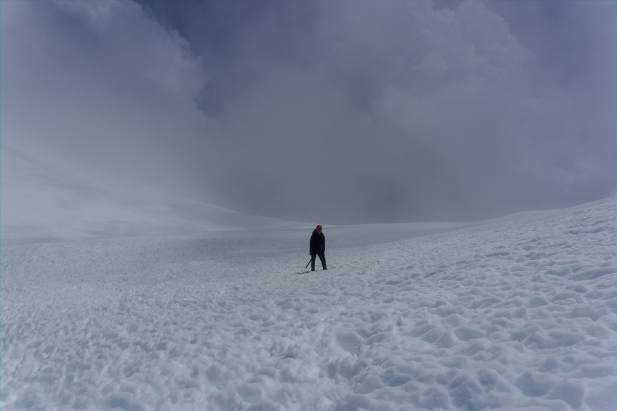
As we walked the flat portion of Hidden Valley camp’s snowfield, over a lot of watermelon snow, we heard the first thunder in the distance. We were still well above any tree cover. Anxiously we packed and quickly made our way to Horse Camp where we had tree cover. Tree cover is not ideal… but I’ll take ground voltage differentials over a direct hit anyday. We got rained on, scared, but made it to the car for a very, very, very tired drive home.
The Lessons Learned
- Lacking cardio fitness likely exaggerated my climbing partner’s his altitude sickness
- Altitude sickness can be hard to gauge with summit fever pulling and the vagueness of severity.
- We were actually making risky call to continue going up
- Climb with people who you trust WILL turn themselves around (and do them that favor yourself as well)
- Arriving to camp so late left little time for acclimatization
- Get as much rest as possible with an alpine start
- A likely contibutor to the altitude sickness was our lack of sleep (few hours at most)
- Be weary of in-field navigation changes, question why you think that is the right thing to do
- Rock bands in clouds are hard to navigate, they all look the same up close
- We started climbing towards a chute linking Casaval ridge before realizing this was not correct and certainly not easier to climb.
- Weather happens quick, without forecast warning, trust your gut when clouds tell you something is brewing